Sunday, January 29, 2012

Grief and Resilience

January 22nd – 29th
 On the morning of January 22nd, (January 21st in the States) we learned that Darrell’s father had passed away. While not unexpected, as Norbert had been receiving full-time care for more than a year, it was still a sad shock. Darrell made flight arrangements and we drove straight over Arthur’s Pass to Christchurch so he could catch his 7 pm flight. I stayed in Christchurch with two dear friends of Vera’s, Matt and Margaret.

Christchurch, as most of you are aware, has suffered some horrific earthquakes over the past 17 months. The first major one, in September of 2010 (magnitude 7.1), was centered west of Christchurch, and caused some damage including to Matt and Margaret’s home. They were just determining how much to salvage when the second major earthquake (magnitude 6.3) hit in February of 2011. This earthquake caused tremendous damage to the CBD (Central Business District) and 182 people lost their lives. Since the first earthquake, there have been continuous aftershocks. The first morning I was in Christchurch, there were three earthquakes. I only felt the largest one, a magnitude 4.5 quake that shook my coffee and jiggled my chair. Very eerie.

Each day I stayed with Matt and Margaret I took the bus to a different part of Christchurch and walked around. Each place showed both damage and rebirth. The CBD is no exception.

One area of the Christchurch CBD
Most of the CBD is still cordoned off. No one has been allowed in many of the buildings so they still have the purses, coffee cups and computers that were left almost a year ago. One of the areas hit the hardest was Cashel Mall. After the rubble was cleared, some of the businesses began again in new shipping containers in an area called ReStart. There is also a memorial to the many people who lost their lives there on that day.

ReStart District on the site of the Cashel Mall
Another view of the ReStart shopping district
Many volunteers worked in the aftermath of the quakes, and there are still volunteer efforts being organized to improve the city. One group is called “Greening the Rubble” and the white board in the background states the time and place of the next volunteer action.

Beautification courtesy of "Greening the Rubble"
I hiked up the Sumner headlands south of Christchurch, and got a view back to Sumner and Redcliffs where part of the cliff came down in the February earthquake.  Then another strong earthquake hit in June of 2011, and caused further damage to these cliffs and of course the homes built on the cliffs…

Cliffs above Sumner, just southeast of Christchurch
Close-up of Cliffside home
I’m not often contemplative, but the yin and yang of being confronted so directly by the power of nature and the resilience of the people, while also reflecting on the life and death of Darrell’s father and the impact on his family, encouraged somber thoughts.

Darrell is back in New Zealand now, and he is also changed from the intense experience of being with his family and putting his father to rest.

I'll leave you with a beautiful picture of the beach showing the area where we are now staying. The beach stretches for miles and miles and is wonderful for long, and contemplative, walks.

The beach stretches to the far right for a long, long way...

Punakaiki and Hokitika (I love Maori names!)

January 18th to 22nd
There are relatively few roads in NZ, so when we drive to out of the way places like Karamea and Farewell Spit, we need to backtrack on the same roads. We almost didn’t drive to some limestone arches because of the one-lane winding gravel road to get there and back, but the lure of seeing the arches overcame the fear of meeting another campervan on a narrow spot on the road!

Darrell under one of the limestone arches
After our two hikes to the arches, we backtracked all the way to the library at Westport again where we got a strong enough wifi signal to work in the van in the parking lot. Then we bought some groceries and headed down the road to a free campsite by the Fox River.

The next morning I went for a hike with a woman who was camped alone just behind us. Maria has been traveling for the past two and a half years! She began from her home in Spain and spent a lot of time in the Middle East before going to India and eventually to New Zealand.  She will continue to travel until she runs out of money.

Maria by our tree "cave"
Maria and I were trying to reach a cave and ended up on the wrong trail. We kept following orange flagging, but after an hour of bush whacking we figured this wasn’t the route! So we took a picture of a tree "cave" we found in case we never found the real cave.

We backtracked to the correct trail, and went into the cave with a young Swiss and French couple that had much better headlamps than we did. The cave has been a popular tourist destination for over a hundred years so it isn’t in any kind of pristine condition, but it was still fun to go into.

Fox River Cave
After that adventure, Darrell and I continued down the road to Punakaiki, where the “Pancake Rocks” are accessed by a walkway that gets a lot of tourists. After the quiet places we have been, it was strange to be among busloads of tourists! These limestone rocks have an interesting erosional pattern that gives them their name.

Punakaiki
There are also blowholes and surge pools when the tide comes in. At low tide the kelp hangs on the sides of the pool. And then at high tide, the entire wall and rock get inundated with waves and somehow the kelp hang on for the ride!

The kelp hang like a row of ties at low tide
Larger view of this same pool at high tide with the waves crashing over the kelp and rocks
The next day we spent some time looking for more glacial marine deposits and then took a walk by the glacially fed river at Hokitika Gorge. We camped in the parking area for the Whitcombe Track but I couldn’t find any information on this track in my tramping book, and when we followed the trail we ended up in a pastured area with cows and sheep!

Darrell enjoying the gorgeous glacial blue Hokitika Gorge
The next morning we drove into Hokitika and worked at the very pleasant library. I can’t say enough good things about the libraries! Besides using the wifi, I almost always end up buying one of their $2 paperbacks as well. Then the next library down the road gets the old book and I buy a new one.

Hokitika is most known as the pounamu (jade) capital of New Zealand. We spent some time admiring both the traditional and modern jade carvings in town. The picture below shows the clocktower (common in many towns here) with the Maori carving studio and jade store behind it.

Hokitika Clocktower
For lunch, I bought a Whitebait sandwich. The West is mad for Whitebait. This is basically a tiny (1 inch) fish that gets caught in nets. So it isn’t like yummy fish and chips.  Instead, they take a handful of whitebait and mix it with an egg and fry it up. It looks like an egg sandwich with a bunch of fish eyes staring up at you. Hmmm. I am NOT mad for Whitebait but I am glad I tried it!

We continued south to Ross, where Darrell was trying to find a Pliocene marine deposit with shells in it. Ross is still being actively mined for gold, so much of the area was off limits for exploration. But we happened upon a man who owned a limestone quarry and he gave Darrell permission to have a look around. We actually found the deposit there and Darrell collected some of the shells.

Darrell and the almost hidden Pliocene marine deposit
Ross was the furthest south we ventured for now. We headed back north and camped at a pretty little lake that had a DOC campground. It would almost remind me of Minnesota except for the Southern Alps in the background!

Mindy at Lake Mahinepua

Friday, January 27, 2012

The Wild West

January 15th – 17th
 As we left Golden Bay in our rear view mirror, we saw storm clouds on the horizon and then rain splattered the windshield.  The West is known for its wild and wooly weather! It is also known for the 1860’s gold rush.  We stopped at Buller Gorge and crossed a 110 m “swing bridge” to see the fault line from the 1929 earthquake (magnitude 7.8), and remnants of the gold mining in the area.

Darrell on the "swing bridge" over Buller Gorge
There was an overgrown path to see a giant white pine (not the same species as our N.A. white pine) of which only about 2% remain in NZ…  We were accompanied by a Tui, the friendliest bird here, with the most melodious song. I’m not a great bird photographer but I did manage to get a picture of this handsome guy with his white wattles showing.

Tui
We camped along the river in the old gold rush town of Lyell, which has no buildings left standing and is now a DOC campground.  We were the first to arrive and it was already after 5 pm so we thought we’d have a quiet night of it – until other camper vans descended on the campgrounds, as well as a group of 4-wheel drive vehicles filled with fathers and sons out for a 4x4 adventure. Yikes! They were actually reasonably quiet but there were 25 vehicles now altogether!

The next morning I walked in the misty forest along the river to visit the old cemetery and see some remnant gold stamping equipment.

Sunlight filtering through the forest near Lyell
We followed the river to the coast, and went to see the seal colony near Westport. The seals were fairly scarce but the wekas, like rugby balls with legs, were all over!

Weka
We used the library in Westport and then drove to the far north of the West side, to a darling town called Karamea, and then to the DOC campground at Kohaihai. This area has some of the mildest and sunniest weather on the West side, and we really did get nice, sunny days! We stayed two nights here as we were camped right on the beach and there were great walking tracks for me to explore while Darrell worked.

Arch at Scott's Beach along the Heaphy Track
I headed out early the first morning to head up the Heaphy Track, one of the Great Walks of NZ. This track stretches 78 km all the way over to Golden Bay, but I just went two and a half hours up the coast. This southern bit of track follows the beaches with views of the ocean through the Nikau Palms.  It was easy walking and just spectacular!

Nikau Palm along Heaphy Track
Darrell took a run to Scott’s Beach later and we got our first use out of our solar shower. It is just a heavy plastic bag filled with water that can drain from a shower nozzle.  You place the clear side to face the sun, and the bottom black side absorbs the heat, so the water heats fairly quickly. It worked great!

The major down side of the West are the SAND FLIES! They are small, exceptionally evil black flies that especially like ankles, but will take other skin as available. Their bite feels like they are taking a chunk from you, and if you can’t stop yourself from scratching the bites, you are doomed to itch for days and days afterwards.

We went out on the beach to enjoy this last sunset view, but the sand flies quickly drove us back in our van again!

Sunset view from our van

Wednesday, January 25, 2012

Abel Tasman National Park, Golden Bay, and Farewell Spit

January 10th – 14th

Despite warnings about rain, we headed west to Nelson. This gateway to the northwest often records the most hours of sunshine in NZ, but this year they also had record rainfall and devastating landslides. We continued through Nelson to the smaller town of Motueka, where we visited the i-site and made a reservation for the morning water taxi ride to Abel Tasman National Park.

We also found out about the local council campground where, for only $5 per night, there is a nice park, public restrooms and an outdoor shower as it is near a saltwater pool on the edge of the bay.  I went swimming (brrr…) and Darrell went for a run. We both looked at birds in the flats as the tide went out. Lovely spot.

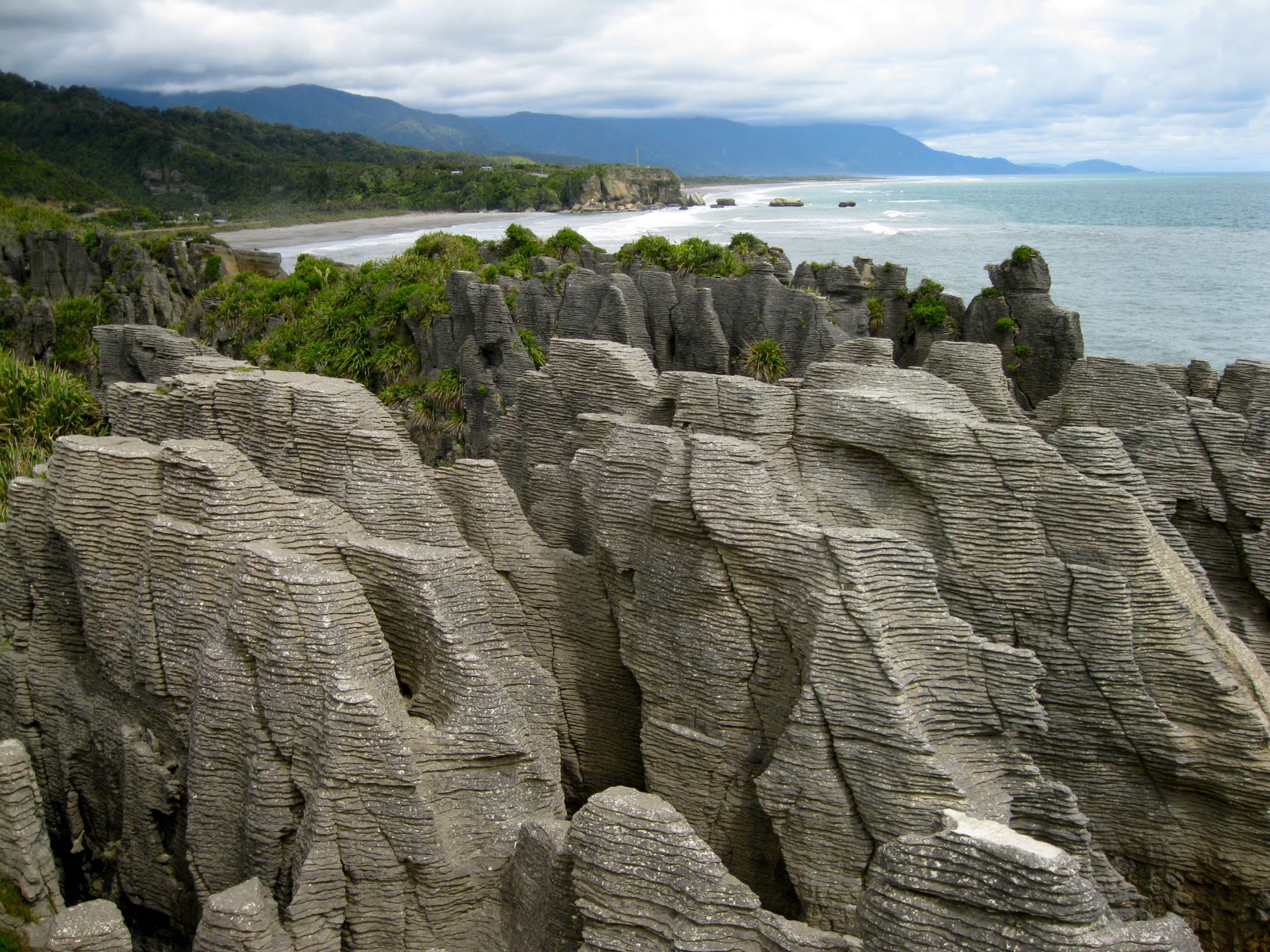
The next morning we boarded the water taxi – on land! It was then pulled by a tractor across the sand flats to where the tide was coming in and we were afloat. If you’ve seen pictures of this park, you may have mistakenly thought it was in the Caribbean…

Abel Tasman National Park
The boatman gave us a bit of a tour as well as a taxi ride. We first went to Split Apple Rock, which you may have seen in various advertisements. We slowly went by a rocky islet where some seals were hauled out, and then got dropped off at Bark Bay.

Split Apple Rock
If you have a week or so, you can kayak all the way up the coast to the far end of the park and then hike back along the coastal trail.  Most people do some smaller version of this – made easy by the water taxis that will drop you off and pick you up wherever you want. We had our absolute best weather day for this hike (weather forecasts are highly unreliable here) and looked a little enviously at people in kayaks as we sweated with our packs on the trail. Our total hike was about 25 km (15 miles) so we were pretty tired at the end of it!

Most tracks have stoat traps along them. NZ didn’t have any terrestrial mammals prior to the first Maori arriving, so flightless birds were filling the ground niches available. Now rats, pigs, cats, and stoats (a kind of weasel) prey on these endemic birds. We often see signs for poison pellets as well as the traps.

Stoat Trap
The tidal range is about 6 meters so some of the tracks have both a high tide route that goes inland, and a shorter low tide route that cuts across the beaches. The coastal trail ends with a long bridge over a tidal flat.

Darrell at the end of the trail
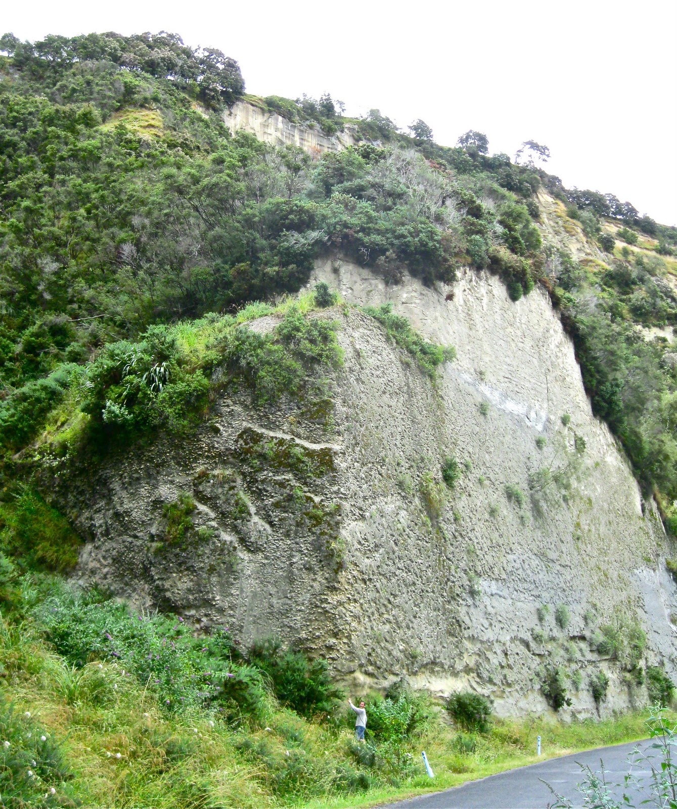
The next morning we worked in the van during the rainy morning. Darrell somehow meets the challenges of staying caught up with his work while we are on the road…  Then we drove across the Takanaki Hill in mist and rain so we missed the views and the walks to see hobbit holes. We dropped down to Golden Bay on the other side and meandered along verdant trails that afternoon. Our first stop was a small limestone gorge, and then we went to Pupu Springs, the largest freshwater spring in New Zealand with 14,000 liters per second of water bubbling up! There was a lovely walk around and through the springs area. The water is incredibly clear and beautiful.

Beautiful Te Waikoropupu (aka Pupu) Springs
After this short but memorable walk, we went to check out a free camping spot and ended up taking a hike along some old water races built by the past gold miners in this area. The hand-dug races still had water running in them, and in places the walkway hung over the steep hill next to them.

Water Race and Trail, hanging off the steep slope
There were myriad bryophytes including the world’s tallest moss, Dawsonia superba. I took a ridiculous number of pictures of wee green plants; mosses, liverworts, ferns, small angiosperms – a wet fairy world!

Huge variety of wee green plants!
We treated ourselves to dinner at The Mussel Inn, a local institution along Golden Bay with live music almost every night. We sat around the outdoor fire after dinner, visiting with a couple from Christchurch who told us about their experiences with the earthquakes. While many people are moving away from Christchurch, mostly due to the significant and frequent aftershocks, some are staying and working to help their city rebuild.

We camped just off a quiet road that night and it rained and rained and rained.  The next morning we had to shovel some gravel under our tires to get out of the mud! We parked the van by the harbor in the small town of Collingwood to get some work done with a view to the wind-whipped waves.

Storm clouds and a rain storm heading our way!
That afternoon we drove to the end of the road and met our ecotour out to Farewell Spit, the long sandy spit that curves over like the bill of a curlew protecting Golden Bay. The spit is closed except for two tour companies that drive huge-tired vans over the sand out to the lighthouse near the end of the spit. On the way we saw New Zealand Fur Seals on the beach, and got out to experience the blowing sand creating and moving large sand dunes. The wild weather gave us a more dramatic tour than many people get. In the photo below, Darrell is walking in the background and two brothers are trying to get a kite ride from their jackets in the wind. They were hilarious to watch!

Trying to get a ride from the wind.  Note the moving sand!
We had some rain on the way, and then a rainbow came out while we were enjoying some tea and biscuits (cookies) at the light house. The 19th century lighthouse keepers were the ones that planted the trees to create their own windbreak!

Fossil dolphin and rainbow near the end of the spit
The spit continues a short ways, and is growing a little every year as the wind continues to blow sand. There are protected bird sanctuaries there for gannets and godwits, but we couldn't get close enough to see them.

Every crevice of our exposed bodies and clothes were covered with sand when we returned! We spent two more nights in the area; first on a gravel bar near the coast, and then at Pakawa Beach Park, one of the nicest and most mellow campgrounds we have stayed at. Some caravan parks have room for hundreds of campers but this was a small one right on the ocean. While Darrell prefers to camp in more isolated areas, I like the campgrounds every 3rd or 4th day so I can wash some clothes, take a shower, and feel a part of the Kiwi families and other travelers in the area.

The lovely and empty beach at Pakawa, Golden Bay

Tuesday, January 24, 2012

Wellington to Marlborough Wine Country

January 4th – January 10th
We finally retrieved the car from the VW dealer (see last post) and happily headed back towards the coast. I don’t mean to dismiss what the inland areas of the North Island of NZ can offer, especially the mountainous and geothermal areas, but there is an awful lot of pasture… I guess I can’t complain unless I become vegan, and quit wearing my beloved wool clothing, but there is a much larger amount of deforested land than I anticipated.

We found a lovely and free camping area near the beach at Te Horo, just a ways north of Wellington. Darrell loves to run on the beach, and I love to poke around and see what the ocean brings within reach. Each beach has its own personality and we have often had long, long stretches of beach to ourselves. Beautiful.

Wellington is the capital of New Zealand and a nice size city of 164,000 (compared to Auckland’s 1.2 million). It is also home to the University of Victoria and is nicknamed “Windy Welly”.  We were lucky enough not to receive the lashings of horizontal rain Welly is known for! Rain boots here are known as Wellingtons or, more commonly, gum boots, from what the gum workers wore to extract the kauri gum (see last post).

Occupy Wellington with the Parliament "Beehive" building behind it
There is a motor home park right downtown next to the ferry terminals. It is super convenient for walking around Wellington, but it is a little strange to be densely parked with so many other campervans right next to one of the main roads into the city. For $50 per night, you get a piece of the asphalt and the codes to the bathroom. For downtown living, that isn’t too bad!

Happy pigeons in a Wellington fountain
We stayed two days and did the city thing including nice restaurants and the new Sherlock Holmes movie. Best of all was the wonderful and free Te Papa Museum. It is four stories tall and packed with information about New Zealand from before it was part of Gondwanaland to today. Awesome. They had a wonderful exhibit about the Waitangi Treaty where we learned more than we had when we went to Waitangi! They had a full-size marae inside, as well as exhibits from World War I and II and their impacts on New Zealand. Truly one of the best museums I’ve been too with lots of interactive goodies for kids.  And it was so nice that it was free because you could come and go, visiting the museum in small doses and not getting too overwhelmed.

Beanbag chairs outside restaurant near Te Papa Museum
We took a tram up to the botanic garden where we got a view of Wellington, and wandered on the trails. While not defending British colonialism, the Brits do tend to create large and lovely botanic gardens wherever they go!

View of Wellington with University of Victoria field in foreground
Within the botanic garden was a Japanese Peace garden where a continuous flame burned. The memorial said the flame came from the fires caused by the nuclear bomb at Hiroshima. New Zealand is famously anti-nuclear and barred any nuclear-armed or powered ships from their harbors. In response, the USA kicked NZ out of the ANZUS treaty. Two years later, as most of my readers will remember, Greenpeace’s flagship, the Rainbow Warrior, was bombed and sunk in Auckland Harbor by French agents before it could sail to protest French nuclear testing in Tahiti. This further resolved EnZed’s (as NZ is pronounced here) stance against nuclear power.

Peace garden with flame from Hiroshima in temple
We celebrated my dad’s birthday (Hi Dad!) by taking the morning ferry from Wellington, North Island across Cook Strait to Picton, South Island. We were excited to get to the South Island as it has only a fraction of the population and has a lot of land in National Parks. Time to move from cows to kiwis! But we weren’t exactly leaving civilization behind yet…

Our first stop was in the Marlborough region, where some of the loveliest Sauvignon Blanc’s are made. We toured two wineries and then set up camp in nearby White’s Bay.

White's Bay - note the sea arch in the background!
The next day we toured another two wineries, including Spy Valley Wines, where we were the only two tasters there. We visited with the woman informing us about the wines and discovered she had also lived in Boulder, Colorado while her husband went to school there. He switched from physics to producing wine.

Vineyards in Marlborough
We camped the second night right near Monkey Bay, a wine-label we buy frequently as it is marketed in the States and sells in our price range! The name came when two young winemakers hiked to the bay and realized it was a memorable name and had a good story of a lost monkey behind it. Voila, the label was born!

Darrell at Monkey Bay
I took a long walk the next morning, first along Rararinga Road where I met Dorothy collecting her mail. Even friendlier than most Kiwi’s, who are amazingly social, Dorothy invited me in, introduced me to her husband, gave me two jars of rhubarb preserves, and told me about a website that featured mailboxes from her neighborhood. New Zealanders do have some of the most interesting mailboxes we’ve ever seen. Darrell and Lindsey spotted a fish mailbox in the northland, and we’ve seen plenty of lively ones throughout the country. Here are just two of the many from Rararinga Road!


Aliens on a bicycle?
I walked along the beach on the way back to our campsite.  I had the beach to myself with just an artistic reminder that other people have been along this beach as well!

Driftwood sculptures along Rararinga Beach

Friday, January 20, 2012

Raglan to Wanganui

December 28th- January 4th
We had a lonely drive south on Hwy 1 after waving goodbye to Lindsey at the Auckland airport (see last post). Our destination was now Raglan, a surfer town on the west coast.  Since most locals and many tourists head to the white, sandy beaches of the east coast, we went west.  Raglan had a large tidal flat, so along with surfers, there were many kite-surfers and fisherman – all in the best places for their sport along the coast. The local i-sites (information centers) are the best places to get clued in to camping spots that aren’t necessarily on the map. We learned about a private campground near the beach that was land that had been taken from the Maori many years before and was now recently returned.  The golf course reverted to grassland and we got a prime place to camp for $10.  I went for a long walk along the beach while Darrell worked, and then he went for a run on the beach while I hand washed some clothes and even washed the van. Living in a small space, it is critical to give each other some alone time!

UFO being used as a home in Raglan
We use the car battery to recharge our computers, and we didn’t know then how quickly we drained our battery with the inverter, so the next morning we had to get a jump from one of the guys at the camp.  Later we bought our own jumper cables so we could charge the car battery off the auxiliary battery if we ran it down too far!

Raglan was pretty hip and nice, but we moved one beach town farther south to Kawhia which promised to be even more laid back.  Kawhia is one of the places where there was a historic canoe landing (usually considered to be in the 14th century) and it remains a town with a sizeable Maori population. We stayed at what is known as a POP (Park Over Property) where, for a minimal fee (free to $10) you can stay on someone’s private property, but they rarely have any amenities.  So you need to be “self-contained” since there is no potty, showers, etc. We had a lovely tidal river view though so we stayed two days.  I walked into town and used the public toilet since it was so close. I am not mentally prepared to clean a port-a-potty so we haven’t used it yet!  Thank goodness NZ has many nice public restrooms!

Entrance to Kawhia town and harbor
Kawhia also has a hot water tidal beach like we found on the Coromandel Peninsula but it was much less crowded!  We couldn’t find a great hot spot though and it was raining, so we didn’t last too long in the tepid water.

We wound our way out of Kawhia, returning to the highway; a relief after driving narrow, windy roads with few guardrails and many drop offs… On the way south we cruised through Otorohanga, whose main road has Kiwiana signs hanging on both sides.  Kind of silly, but whatever lures in tourists helps the bottom line! See if you can spot the kiwi fruit, fern (symbol of the All Blacks national rugby team), sheep, jandals (Japanese sandals) and then my eyes can't focus any farther!

Kiwiana symbols line the street in Otorohanga
We checked out some interesting rock formations near Te Kuiti and then stopped to see some amazing driftwood sculptures at Wade’s Landing near Raurimu.  They are amazing!

Darrell dwarfed by the Giant Moa
Our next detour took us along the incredible Wanganui River. Darrell ogled the huge, bedded Quaternary (last 2 million years) deposits along the road to Pipiriki (don’t you love these names?)  and then along the Wanganui River Road.

We spent New Year’s Eve at the quietest campsite I’ve ever been at.  There was one other couple besides ourselves.  The ground was so soggy from all the rain that it was like walking across a sponge! The other couple was there for a family gathering at the local marae.  A marae, as I understand it, is the tribe's community center where all important group decisions and celebrations take place.

Marae along the Wanganui River
The next morning, we had more Kiwi-road adventures. Small landslides blocked some areas and hadn't been cleared yet - it was New Year's Day after all!

Rain plus steep hills equals landslides
The deposits along the road made it interesting in other ways also! There is a giant fossil oyster bed in one of the deposits. Darrell is at the bottom of the exposure in the picture below.

Darrell (tiny dot above) and the giant oyster bed
As the river valley widened out, we saw signs of civilization again. Besides omnipresent cows and sheep, there are many tree farms. You can drive a long time between wild places, especially if you don't get off the main roads...

Nature doesn't usually grow trees in rows!
At the end of the river, we came to Wanganui - which turned into one of our favorite places. At the friendly i-site we could surf the internet and charge our computers at the same time! You don’t know how exciting this is! Plus Darrell had some interesting geology to do, so we tramped up and down long beaches collecting shells from different glacial stages represented in the cliff sediments. We camped in three different places over four nights and actually felt like we were getting to know the town by the time we left!

Geology on the beach - life is good!
The van was ready for its 90 km check up, so we drove to the VW dealer in Palmerston North and walked from there to downtown.  We spent the afternoon at a local cafĂ© and then at the library where we were introduced to the lovely Aotearoa People’s Network – a free wifi service at many libraries in New Zealand.  This is a true gift to travelers. (Which I am using now!)

Last note: Oil changes in NZ are like in Australia – you pay closer to $300 than the $30 we pay at home.  I haven’t figured that why. Thankfully, the dealer we bought the van from also included our first oil change so they paid the bill. And, while gas is a little over $6/gallon, car insurance is incredibly cheap. There are limits on suing over car accidents so our “high” rate as Americans who drive on the other side of the road, was $347 for the entire year! Isn’t that what folks pay for a week in LA?